"I’m tempted to say the sky’s the limit,” says Geoff Hilton, WWT’s Head of Conservation Evidence. “But actually, it isn’t!” He is enthusing about a very 21st-century type of conservation – the analysis of wetlands and other habitats by satellite. “Every corner of the Earth is now viewed at regular intervals, from days to weeks. And different satellites are viewing the world through the whole spectrum of light, from infrared to ultraviolet. It’s extraordinary – we can monitor the state of faraway valuable wetlands without leaving Slimbridge.”
A different view
With each pixel in a satellite image representing an area of 10-50m square, any changes in the state of a wetland are easy to spot. “We can monitor all kinds of things, from the area of open water to the extent of flooding and even certain types of pollution,” says Geoff. “Recently we have been able to monitor the effect of rice farming in the Mekong Delta in Cambodia, one of our priority hotspots. We can see the effect of changes in land use, such as dams and deforestation.”
The sheer detail that can be revealed by satellites is astonishing. “Some satellites reveal reflectance from the surface of the water that gives a strong indication of how polluted it is, or how much sediment it is carrying,” says Geoff. “Scientists are even starting to use changes in the way wetlands look to contribute to public health, such as predicting cholera outbreaks. This means that we can help people as well as wildlife, and we’ve probably only scratched the surface of what can be achieved.”
 Satellite imagery of the Mekong River Delta in Vietnam
Making moves in Madagascar
One of our most useful applications of satellite images so far was in Madagascar. The Madagascar pochard was rediscovered in 2006 after the last previous record in 1991. This was completely unexpected, as the species was thought to occur on only one wetland, Lake Alaotra, but instead turned up 330km away on a different type of lake in the highlands. “There were only about 20 birds in the new population, so it was critical that, if the species was to be maintained or increased in the wild, we would need to find a new location for them,” reports Geoff. “We couldn’t possibly visit all the potential lakes across Madagascar, so instead we visited a few dozen, collecting data on their ecological health and working out the landscape factors that tended to point to healthy wetlands. We then looked at those factors in satellite images to work out which of the hundreds of unvisited lakes might be in good shape. We were able to identify some wetland hotspots that very few scientists had visited. If they looked suitable, we sent in teams to monitor the habitats on the ground. We saved enormous amounts of time and expense by using satellite coverage.”
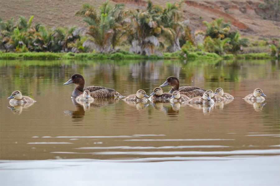 Madagascar pochard ducklings swimming on Lake Sofia in Madagascar
Through the clouds
This real-world monitoring is vital to fine-tune the effectiveness of the satellite data. “We need the flesh and blood site visits to confirm impressions from satellite images,” Geoff says. “The process is one of continual learning and feedback.” One of the most exciting aspects of satellite monitoring is that it is only going to get better. “Until fairly recently, cloud cover was a problem,” says Geoff. “If the satellite passes over and you can’t see what you want because clouds block the view, it is frustrating. However, new systems based on using radar to detect microwaves can see through clouds. Another development is using artificial intelligence to sift through the vast quantities of satellite data, detecting complex patterns far more quickly.”
The resolution of satellite images is also improving. “Researchers have begun using satellites to monitor colonies of large birds such as albatrosses and emperor penguins,” says Geoff. “It’s a long way from that to counting wildfowl from space, but these days you can’t rule anything out.”
Who would have thought that one of the most exciting conservation developments in recent years is one you can appreciate from your armchair?
Satellites and WWT: step by step
How the WWT team use satellite imagery to make a difference in our conservation work.
1 The technology
Remarkably, the small team at WWT Slimbridge simply log on to the satellite images freely available from the European Space Agency and other providers. The images are put into Geographical Information Software on the researchers’ desktop. This can be slow, depending on the processing power of the computers, but advances using cloud technology may improve this in future.
2 Pick and choose
Satellites cover the whole surface of the Earth, but we focus on WWT’s priority areas, where we can use what we learn from the images to guide our work conserving wetlands on the ground. At the moment these priorities are the Mekong Delta in Cambodia and the central plateau in Madagascar.
3 Establish the facts
Satellite images are reliable, but they need to be interpreted correctly, and that is impossible without complementary on-the-ground monitoring, also known as ‘ground-truthing’. Using GPS coordinates provided by the satellite, site visits can calibrate the information from space. The more visits are performed, the more accurately the data can be analysed.
4 Take action
It is possible to view satellite images from specific dates and times in the past, allowing researchers to detect any major changes in the appearance of a site. The changes will then point conservationists towards any areas of concern. We then hope this will enable those on the ground to respond and put any suggestions into action.